@DeletedUser40289030 (talk | contribs) No edit summary |
mNo edit summary |
||
| (3 intermediate revisions by 3 users not shown) | |||
| Line 5: | Line 5: | ||
|size = 350px |
|size = 350px |
||
|caption = |
|caption = |
||
| − | |category = |
+ | |category = Street |
|type = |
|type = |
||
| − | |biome = |
+ | |biome = [[Plains]] |
| + | |navezgane = Y |
||
| + | |confirmed_version = Alpha 15 |
||
|}} |
|}} |
||
| − | '''{{PAGENAME}}''' is one of many [[Road]]s in [[Navezgane]]. |
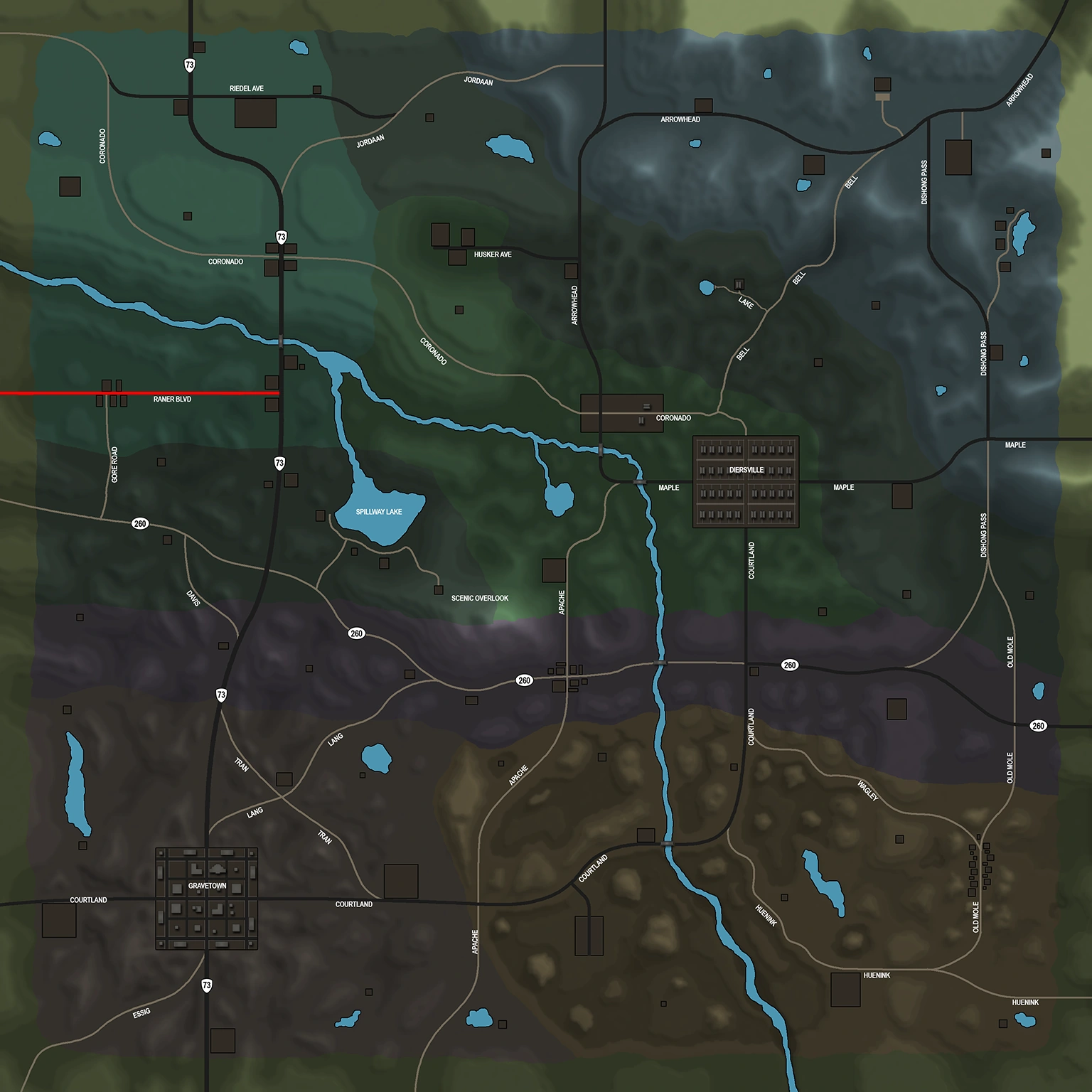
+ | '''{{PAGENAME}}''' is one of many [[Road]]s in [[Navezgane]]. It travels from the western edge of the map crossing [[Highway 73]] to meet up with [[Maple Rd]]. |
== Location == |
== Location == |
||
Revision as of 22:30, 14 November 2016
You can help 7 Days to Die Wiki by expanding it.
| No image yet | |
| Description | |
| Category | Street |
| Game Worlds
| |
| Navezgane | Yes |
Raner Blvd is one of many Roads in Navezgane. It travels from the western edge of the map crossing Highway 73 to meet up with Maple Rd.
Location[ | ]
Raner Blvds location in Navezgane